Land on Map depicts part of today's
Spartanburg Co SC, however,
when Peter first came upon this land, it was Mecklenburgh North
Carolina.
""Peter Lewis, 100 acres Mecklenburgh on both sides of Lawsons fork
of
Packolett above Jones road. Beginning at a post oak on the N side of
said
fork then South 128 poles to a fence thence W 128 poles to a pine thence
N 128 poles to a post oak and thence East 128 poles Beginning.
Date 26 October 1767." File 2231; Grant 386; Book 23, pg 153,
North Carolina Land Grants. "
Note: This deed was recorded in North Carolina
even though the land was in
today's South Carolina. What happened was the 1735 survey between North
and
South Carolina was found to be incorrect and was resurveyed in 1772. At
the time
David recorded this deed the boundary cut across Lawson Fork, which put
it in North
Carolina. The 1772 survey moved the North Carolina line north to it's
present day boundary.
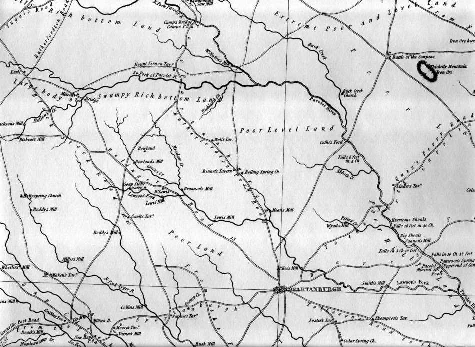
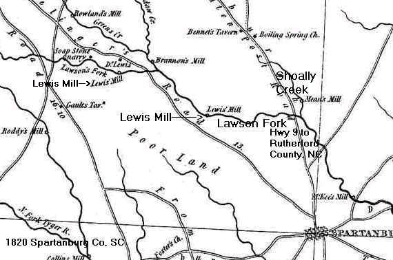
Below is a closer shot of same map
"Lawson Fork, from it's
confluence with the Pacolet River, flows 29 miles northwest to
almost the Blue Ridge Mountains. At the time of Peter Lewis it would
have had a number
of small mills that ground corn for meal. His mill was located about 4
miles west of the Shoally
Creek branch. See map below. The map shows two Lewis Mills. One belonged
to David Lewis
and the other to Peter Lewis. I believe the lower one is Peter's mill
because David Lewis's home
is listed just north of the upper mill."