Return to Elias's Page Return Family History Page
Index of Property Related Links of Elias's
Elias's Bowie Co Deed Index Go to Bowie Co Land Titles Index
Elias Bowie Co Deed Copies Ground Photo's Elias's Land
Land Abstracts Bowie Co Relatives1 Land Abstracts Bowie Relatives2 
Arial Photo's of Elias's Homestead Elias Estate Partition of Land
Topographic Map Elias's Homestead
Story Break down Topo MAP1 Topo MAP2

   TOP

Glenn Thrapp writes:

"The White Home marked on the MAP1 is where I believe that Elias settled when he
came to Texas. My Dad remembered an old house there in the 40's.  A Black family
was living there at that time. When I ran a metal detector over it several years ago I
found several ax heads that were worn down to the handle. I wrote up what I found at
that time and took several pictures. The size of the trees, that lay of the land made me
believe that the cemetery and the home location was chosen by the same people.
Besides it was the only place of size that was anywhere close to the cemetery".

MAP2 below is a little clear as to where the Creed Cemetery is located, in the area
listed as the "ANNA H. HALE SURVEY 878".   Glenn relates this map was created
after 1953, that's when his Grandfather bought the land north-east in the JAS B. McWhorton
Survey 244, from E. T. Page in 1916, in this survey area, the part that looks like a sock on 
a foot, is a pond made by Glenn's Grandfather. Glenn lives south of this area today. 
Elias White's land had to be in the Creed Cemetery area, someday we hope to identify the
exact location. 
TOP


TOP


 TOP


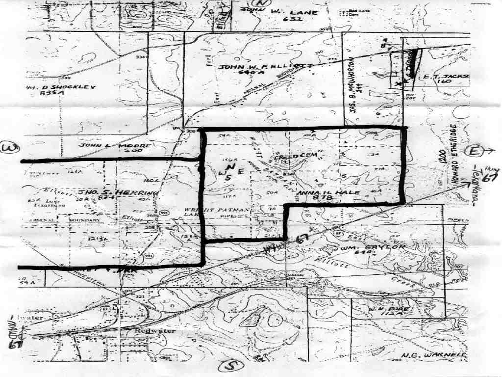
ELLIOTT CREEK (BOWIE COUNTY)

ELLIOTT CREEK 
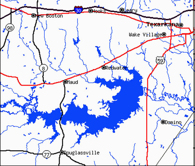
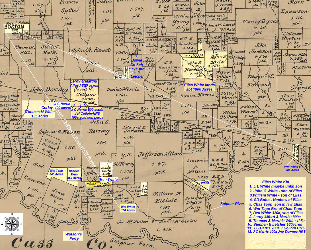
(Bowie County). Elliott Creek, which is intermittent in its upper reaches, rises on the property of the Lone Star Army Ammunition Plant two miles south of Hooks in eastern Bowie County (at 33°27' N, 94°16' W). The stream originally ran southeast for seventeen miles to its mouth on the Sulphur River, five miles east of the Arkansas state 
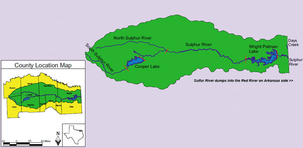
line (at 33°18' N, 94°08' W). Wright Patman Lake, constructed between 1948 and 1957, subsumed a portion of Elliott Creek's middle reaches, leaving the stream in two segments. One segment runs south nine miles from the creek's headwaters to its mouth on Wright Patman Lake. This section runs for most of its course through the ammunition plant property, where it has been dammed to form Elliott Creek Reservoir. The other segment of the creek runs southeast for four miles from just east of Wright Patman Dam to the original creek mouth on the Sulphur River. The land along this part of the stream is heavily wooded, with pines and various hardwoods predominating.


aTOP

Return to Elias's Page Return Family History Page
Index of Property Related Links of Elias's
Elias's Bowie Co Deed Index Go to Bowie Co Land Titles Index
Elias Bowie Co Deed Copies Ground Photo's Elias's Land
Land Abstracts Bowie Co Relatives1 Land Abstracts Bowie Relatives2 
Arial Photo's of Elias's Homestead Elias Estate Partition of Land
Topographic Map Elias's Homestead
Story Break down Topo MAP1 Topo MAP2